The Old Telegraph Track
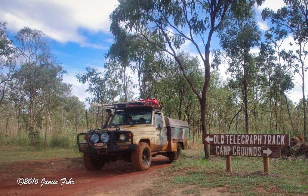
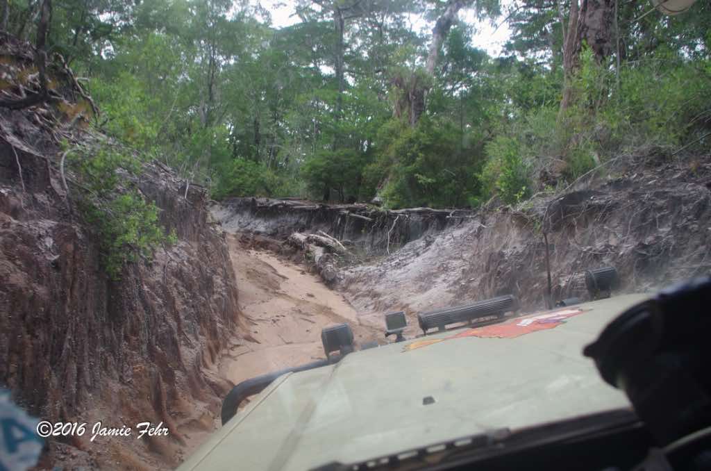
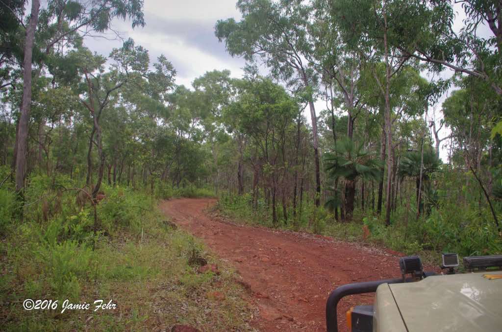
(the “Telly Track” in Aussie slang) is what’s left of the original telegraph track that was created in the 1880s to connect Cairns with Thursday Island. It has become one of Australia’s best 4WD tracks. The Old Telegraph Track is a 350km (700km round trip) rough 4-wheel drive track that passes through beautiful, but very isolated no-man’s land. The narrow road has greatly varying surfaces: dirt, sand, mud, washouts, rocky slopes, a number of excellent creek and river crossings (several of them deep), slippery river banks, and one famous very steep river crossing (Gunshot Creek). Not all of the water crossings are dangerous, but in addition to the ones that are there is sometimes the risk of encountering crocodiles; because both the freshwater and saltwater varieties live in these parts! So vigilance and prudence are key to staying safe. Parts of the track are narrow enough that it restricts passing to the pullouts that have been built every so often for that reason, as it follows the original telegraph line through the Peninsula. Other than the few roadhouses sparsely located in The Tip, all who venture up North are on their own.
Another thing of interest is that the Old Telegraph Track can only be driven during the dry season. It is virtually impossible to pass during the wet season, as the waters of the majority of the rivers and creeks would be far too high to safely cross.
The conditions on the track are ever-changing. Erosion by water during the wet seasons can drastically change the water crossings, so this is a trip that will always challenge the drivers and their vehicles.
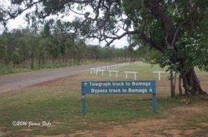
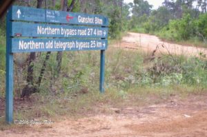
Most people only drive the Old Telegraph Track North, then take the bypass roads back South. However, we drove the Telly Track both ways and did not take the bypass roads at all. We were after the bigger adventure, and because Anthony had a point to prove.
This was partially because near the beginning of our journey, someone told Anthony it was “impossible” for him to drive the Telly Track South. Anthony had a disposition such that when he was told he couldn’t do a particular thing, his reply was “Oh yeah? Watch me as I give it my all!” Sometimes this lead to him doing what others called “impossible”, and other times this lead to him discovering that the naysayers were correct!
So, we successfully drove the Old Telegraph Track both North & South! Personally, I am glad that we did, as now we have a unique story to tell! We had a more memorable journey filled with adventure and stunning scenery.
Let me take you to the beginning,
where this part of my trip began. While I was woofing in Cairns, I was looking for any way to get myself up to far Northern Australia. But the only options I had found up to that point were very expensive and the trip would be short (most of them were fly-in trips). However, my goal was to ride up the Old Telegraph Track in a 4-wheel drive vehicle.
Then I found a guy named Anthony who had advertised on a backpacker’s Facebook page. He would drive anywhere we wanted to go and cook our meals, as long as we paid for his fuel. I reached out to Anthony to enquire about a trip up the Old Telegraph Track to “the Tip”, and he was willing to drive up there with me. His references were good, so I felt safe enough to trust a bloke I had never met to drive me somewhere so very far from civilization.
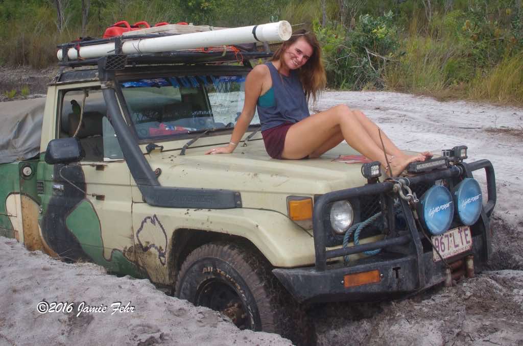
After we had made our plans, an English backpacker named Emily reached out to Anthony and inquired where he was going next. After hearing about our plans, she wanted to join us. Anthony brought this to my attention, and we decided she would be a good addition. At that time, Anthony & Emily were both south of me, in different towns. Anthony was the furthest South, so he picked her up, then they made their way to where I was, in Cairns. Anthony had a good playlist that was playing most of the time we were driving. The songs were mostly upbeat and genres that we all liked.
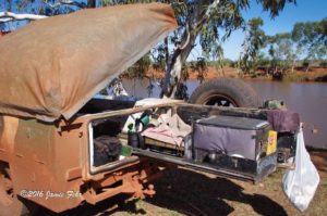
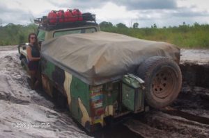
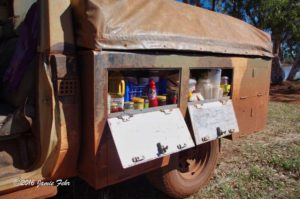
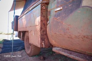
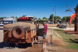
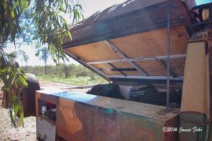
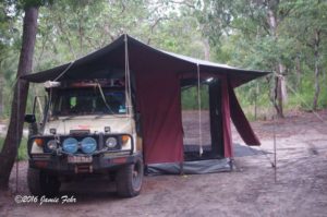
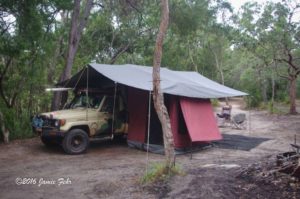
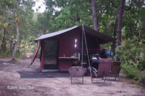
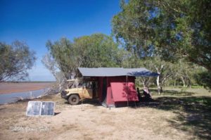
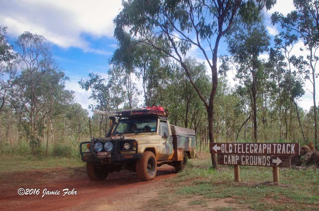
Anthony had a 4-wheel drive Toyota Land Cruiser,
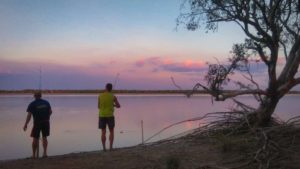
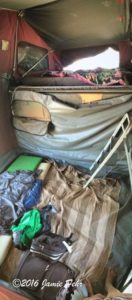
which was set up for off-grid travelling and camping. On the front, he had a ‘roo bar installed (the Aussie slang for “kangaroo bar”), which is the Australian name for a grill guard. In the box, accessible from a door on the back, it had a 12v powered little refrigerating cooler, propane bottles, and a small gas camping stove. Most of this was all on a slider, so when we pulled the slider out, we had our “kitchen.” In one of the side compartments, there was space for storing dry food, things that didn’t need to be kept cool. In part of the other side compartment, there was a water tank with a gravity-fed tap on the bottom. In the rest of that side, we stored our dishes, cutlery, and pots. On top of the box, the tent was stored. Included with the tent were canvases meant to cover the cab and behind the vehicle. That way, if we had rain, we could properly cook and sit in dry comfort. We also had a mesh sheet that we laid down and pinned to the ground behind the vehicle, in our most used area; this kept our feet a little cleaner before we entered the tent. The whole top of the box was on a hinge, and inside the box, there was room for luggage storage. Almost every night, we would set up the tent somewhere new. Inside the tent and in the back over the kitchen, there were LED light strips installed, which provided plenty of light when we needed it. The next morning, we’d repack it and continue on our adventure. If we stayed for more than one night, Anthony would set out his solar panel to keep the batteries charged. This allowed us to keep our cooled food cold and to charge our phones. Some other things Anthony had packed that were very handy: a folding table, some fishing poles with bells, rod holders (so we could leave them on the beach while doing other things nearby), jerry cans, and a jack. We spent lots of time fishing, pretty much every night that we parked near water. How long we stayed out in the wild, away from civilization, was dependant upon our supplies stock: petrol (Aussie for gasoline), propane, food, and water. Stopping to re-supply at the roadhouses was a bit of a cheat, as they were far away from big-city amenities; but they had everything we needed, albeit usually at a higher price. When our tank of water ran out (which it did often; after fresh veggies, our water seemed to be the first thing to run out), we would just take water from the river we were near at the time, and boil it. But this only worked when we had fresh water available.
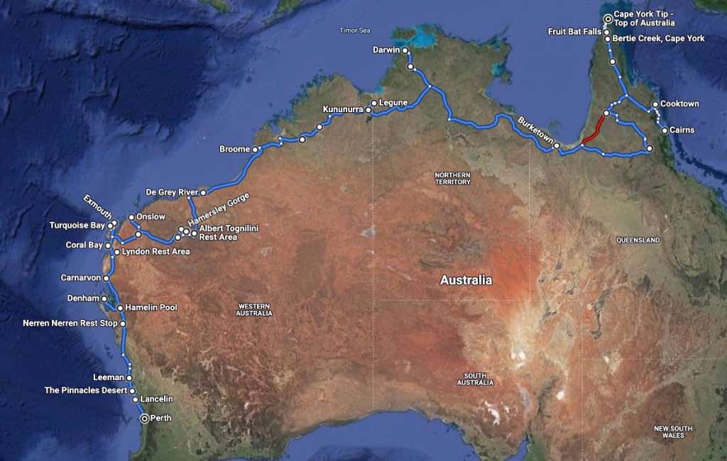
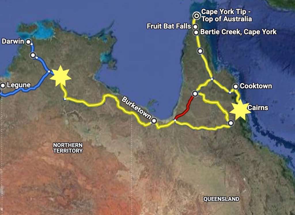
My entire journey (for this portion of my travels) was from Cairns to Perth. But in this post, I will only be focusing on the segment from Cairns, up and down the Old Telegraph Track, to just outside Mataranka (which is about 430 km’s Southeast of Darwin).
The last city that we would pass through for quite some time was Cooktown. We made a quick stop for petrol and got a little welding done to repair something on the Land Cruiser. Other than that, we just passed through. Actually, it was while I was there earlier that I arranged this trip with Anthony. Click here to read about my adventures around Cooktown.
For all the water crossings on the Old Telegraph Track, it is advisable to either have a diesel engine or a snorkel for your petrol engine. This is because during the creek and river crossings water can often come higher than the motor, causing petrol engines to stall when sensitive parts are flooded. We did the drive with neither. All we had was a Toyota Land Cruiser with a petrol motor and a snorkel that wasn’t connected. As such, we flooded on several crossings.
We experienced two different kinds of flooding:

The “easier” type was when the water only briefly covered the motor due to the wave we created when we drove in. My understanding was that once we stalled, we just dried out the distributor, then we were simply able to start it back up and continue driving out. This happened to us while crossing Scrubby Creek. Near the end of this post, you can see a video clip of this, in my Old Telegraph Track South video, at the 2:00 mark.
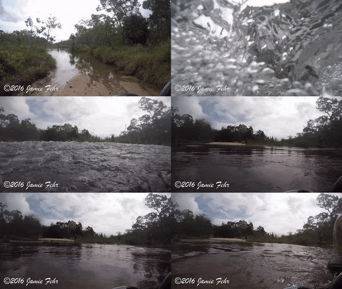

The other type of flooding was when the water was deeper than the motor. When we drove into that, it did not take long for us to stall out. At that point, our only way out was to use our electric winch to pull ourselves back to higher dry ground. Once there, we would let everything under the hood dry out before being able to drive on. This happened to us while crossing Logans Creek. Near the end of this post, you can see a video clip of this, in my Old Telegraph Track North video, at the 6:12 mark.

In comparison, here is a successful water crossing where we did not flood our motor at all.

A few months before I started
on this portion of my travels, while still in Cairns, I met a young lady from the US, her name was CJ. We both lived in the same hostel and became friends as we hung out more and more (when I was not working). After a couple of months, CJ found a job working in the remote Northern town of Coen, at a hotel and restaurant; while I continued living and woofing in Cairns. Later, when I was planning our route North via the Old Telegraph Track, I realized that we would pass right through Coen, the town where CJ was working. I told Anthony that I wanted to stop on our way and surprise her with a visit, so he planned for us to stay there for a night. I even called ahead and spoke with her boss, to make sure she would be working on the day we were planning to visit.
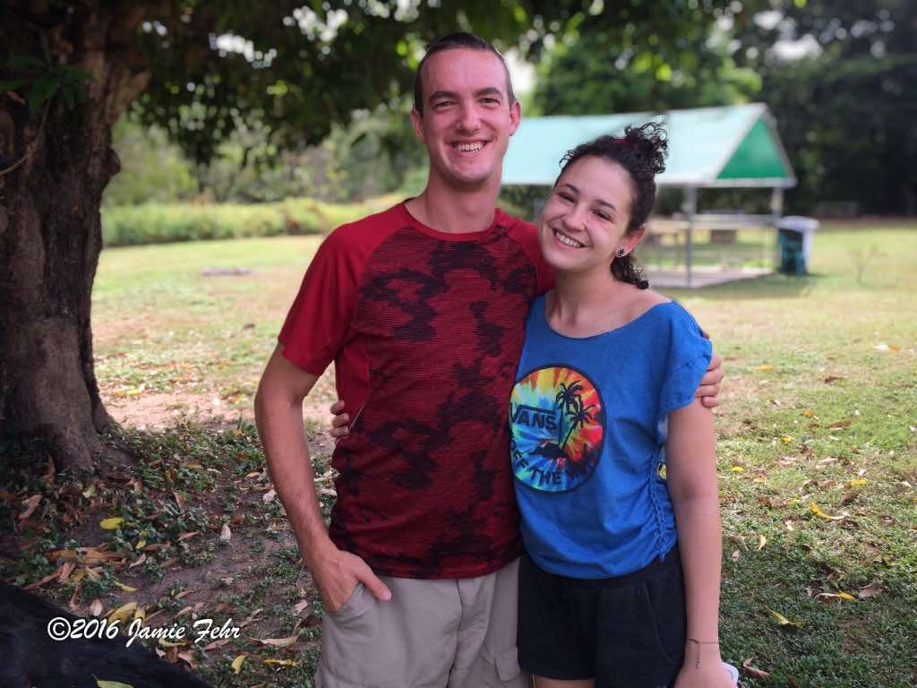
We successfully pulled off the surprise! CJ told me she was thrilled to see a familiar face and have a friend to visit to hang out with for a little while! After her shift was done, CJ joined us for supper, and we were able to catch up.
The next day, we carried on further North.
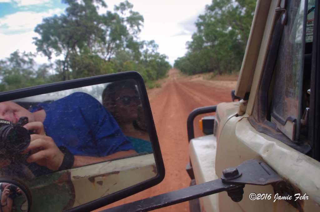
Here is some interesting history about the Old Telegraph Track:
In the early 1880s, the Queensland Government had JR Bradford (Inspector of Lines and Mail Route Services) survey a route along the Cape York Peninsula to Thursday Island for the construction of an electric telegraph line. After three gruelling months, the expedition reached Somerset, near the Northern tip of the Cape. Work on the Cape York Peninsula section began soon after and was completed in 1885, except for 90km between the towns of Moreton and Mein. Between those towns, telegrams were carried by horse and rider until the line was later completed.
The Telegraph operated from 1885 until 1962, with just two wires sending morse code via repeater stations (old homesteads) along the way. The line was upgraded to radio in WW2 and was still used for telephone cable until 1987; when after more than 100 years of service, it was finally closed down.
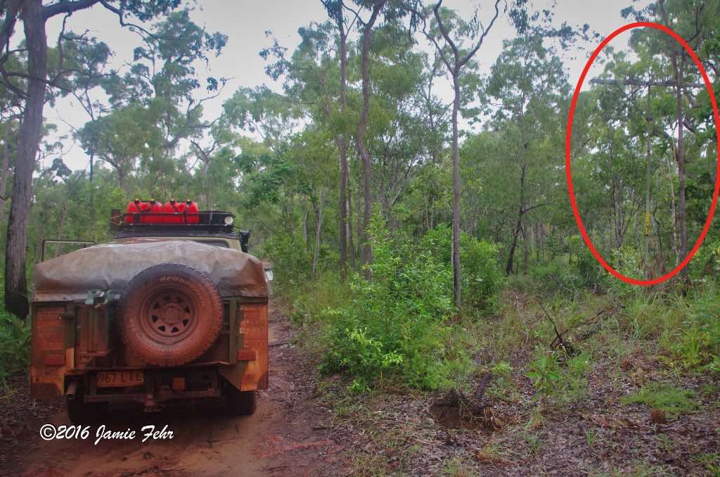
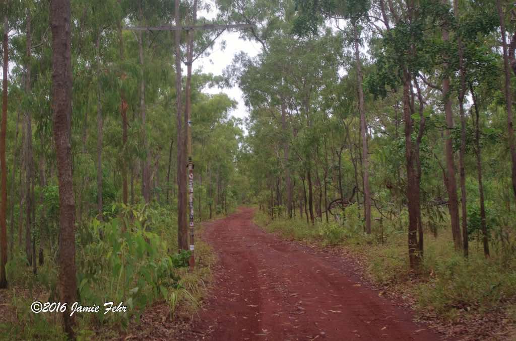

The telegraph line was constructed with galvanized cast iron ‘Oppenheimer’ poles that were manufactured in Germany. Some of the poles are still standing today, over a century after they were first erected! On certain parts of the Old Telegraph Track, they can easily be found, and some of the poles still have their ceramic insulators.
Once opened, this track was the only available road North until the Northern and Southern bypass roads were opened in 1986. At this time, maintenance on the Old Telegraph Track ceased. These two bypass roads are drivable year-round, and allow travellers to get from the Peninsula Development Road to The Tip without having to navigate all of the creek crossings and rough roads. They pass mainly through the highlands to the east and west of the Old Telegraph Track route, are longer, and are heavily corrugated (which makes for a rough drive). Nevertheless, they are in better overall shape, so they take less time to travel.
From the South, the Old Telegraph Track starts at the Bramwell Junction Roadhouse and ends in the North at the Jardine River Ferry. Until the Jardine River Ferry began service, vehicles had to drive across the fast-flowing, 140 meter (460 feet)-wide, saltwater crocodile-infested Jardine River. It is an understatement to say that this was incredibly dangerous, as some people have lost their lives while attempting this crossing!
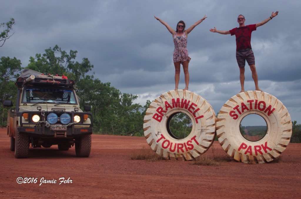
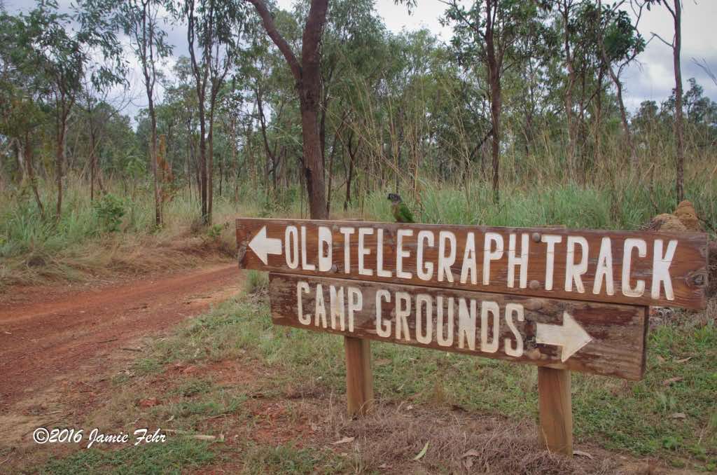

When we got off the highway
at the Bramwell Junction Roadhouse to start out on the Old Telegraph Track, one of the first things that Anthony did was let some air out of our tires. This is called “airing down”, and he explained that this would help us to float over the soft sand and soil, which would reduce our chances of getting stuck and increase our traction. This was so foreign to me, but I had never driven on sand before coming to Australia! It was many days later, before we turned back onto a highway, that we would completely fill up our tires again. If you are curious, click here to learn more about airing down.


While we were travelling on the Telly Track, we always stopped for the night near freshwater. Most nights we had a chance to swim if we wanted to. I remember our first night’s stop vividly. This was early in our trip, and I didn’t know the rhythm, the flow, of things yet. After we had made camp near Elliot Falls, we all went for a walk to go check out the water. The rock that the water flowed over had eroded in such a way that it appeared there were many sections and small pools that the water gently flowed through. It was beautiful to behold! As I was standing there taking it all in, Anthony told us he had planned for us all to go swimming after supper if we wanted. That thought hadn’t even crossed my mind! Wow, did I ever want to!
So, after supper, we brought our bar of soap to the water, and we each took turns having a cleansing bath under the moon. It was special to me.
I was able to forget about my travelling partners for a few moments, then it was just me in nature, having a bath like it was the most normal thing to do. The gently flowing water was refreshing, but not too cold. After we were finished with the soap, we all sat in one of the larger pools and spent some time gazing at the night sky. This was my first time doing something so off-grid, and it was amazing!
As our trip progressed, this truly did become the norm for me. In fact, when we visited the big city of Darwin after 2 weeks off-grid, I could not wait to get out of the hustle and bustle and back into the quiet wilderness!

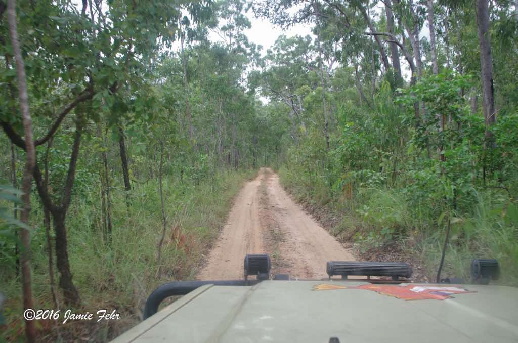
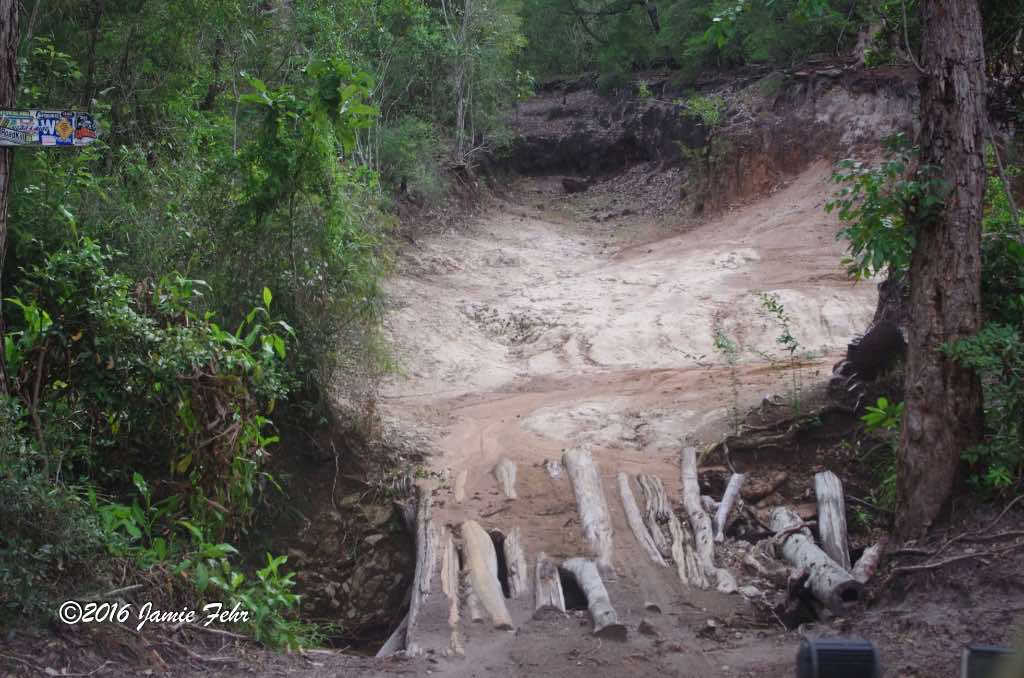
The next obstacle
that we had to drive across was a log bridge crossing Cypress Creek. It was certainly the most unique bridge on the Telly Track, but it wasn’t just any log bridge, this one had a lot of character. Over the years, as the older logs began to rot away and fall into the creek, many “repairs” had been done. New logs had occasionally been added, but some of the new ones were half loose (at least until the soil had worked in between them). This made the bridge once again relatively safe to cross but gave it a bit of a hodge-podge look. And drivers still had to be cautious, in order to stay on the half-loose logs and avoid the gaps.
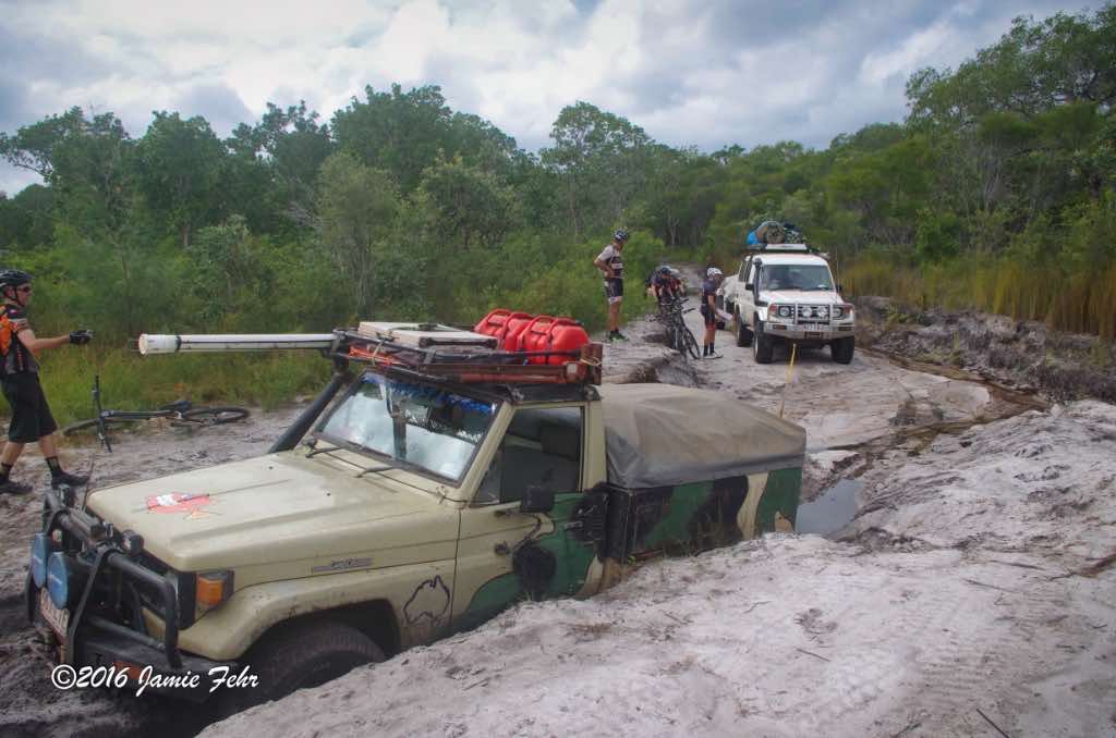
There was a large group of cyclists riding the Old Telegraph Track, along with their support vehicle. Fortunately, we had recently passed that vehicle and some of the cyclists. Because the next thing that Anthony did was drive into a bit of the track that had deep ruts and a high center. Before attempting it, he doubted that he’d make it; but he looked back at the vehicle we’d just passed and mentioned they could help us out if we got into a pickle. Sure enough, he ended up getting hung up, so we needed a tow to get off that soil and drive around.
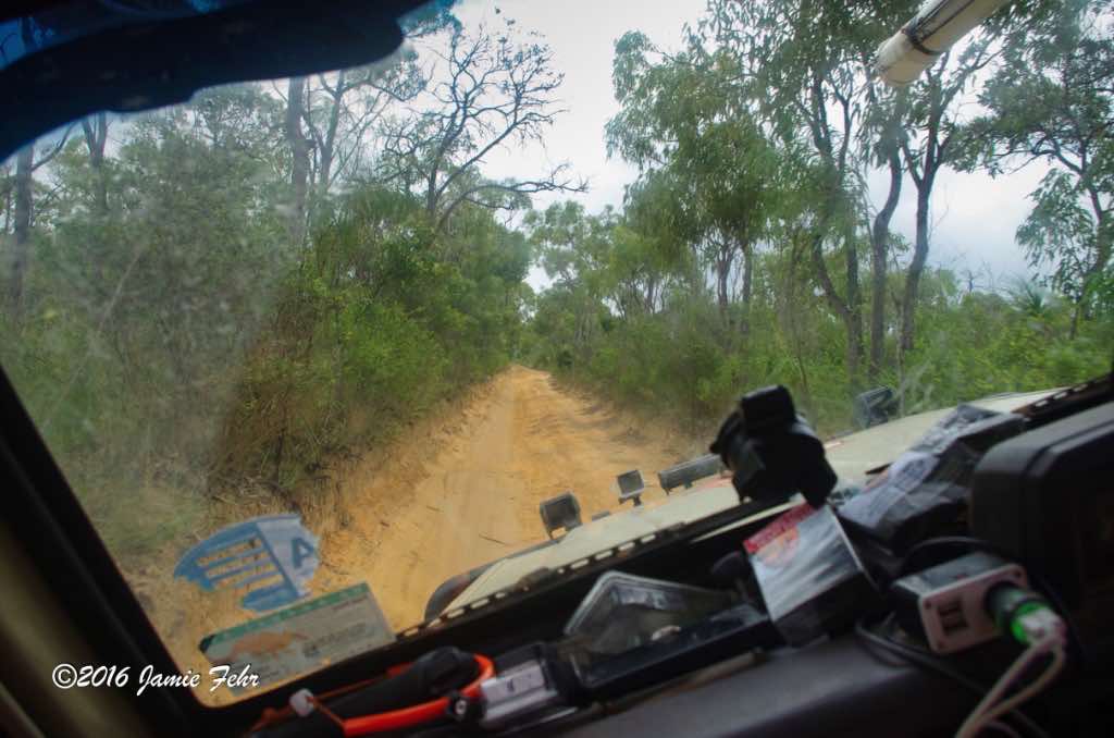

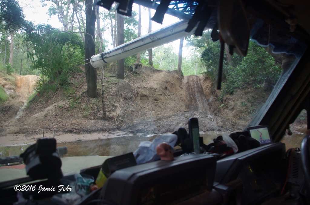
Before crossing Logans Creek, we stopped.
Anthony told us that there were no crocodiles in this water. Then he walked it before he drove it, as he was supposed to do. Upon returning, Anthony commented that the bottom was good, but that this water was quite deep, and there was a very good chance that we would flood and stall. He warned us that the odds were high that some of our luggage might get wet. So we spent some time preparing. My most important bag contained my laptop, external hard drive, other electronics, and passport. My next most important bag contained my SLR lenses and accessories (the camera was with me in the cab). I made sure to stow both of those bags as high, yet protected, as possible. That meant they were stored with our attached tent, under the canvas cover.
Then we drove in. As predicted, we surely did flood and stall, and almost everything got wet. To give you an idea of how deep it was, the water in the cab was about even with the seat! Unfortunately, none of us got a picture of the water that high in the cab. Anthony used his winch to pull his Land Cruiser out, then as soon as the motor was able to run, we carried on our way. I believe there was another path that Anthony could have taken to avoid us flooding like that. However, I think he wanted to give us a trip that we would never forget, so he took bigger risks. Well, he succeeded, I won’t soon forget this trip!
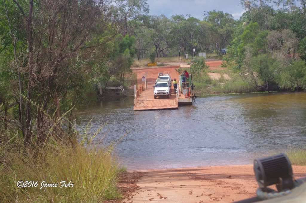
When we came through, in May of 2016, the price of petrol at the Jardine River Ferry servo (Aussie for service station) was $2.45 per litre!
After crossing on the ferry, we kept driving North up the rough track. A short time later, we were forced to a stop because something was wrong with our brakes. After diagnosing the problem, Anthony discovered that one of his rear brake lines had suffered a blowout near the wheel. If left un-repaired, every time he would pump his brake pedal, brake fluid would gush out of that ruptured line. Which, in very short order, would render all of our brakes inoperable. So, he did a quick field repair, by crimping off our rear brake lines. He said that he was not able to isolate just the damaged side, thus neither of our rear brakes would function. Hence, from that point onward, we only had front brakes!


The last store before arriving at “The Tip” was a tourist trap store in a tent with lots of Cape York, Old Telegraph Track Road, and croc-themed merchandise. It was appropriately named “The Croc Tent”. Outside the tent, they also had a couple of crocs in cages, but those were just very realistic replicas.

Later that day,
we arrived at Cape York, the Northernmost point of mainland Australia. We set up camp on the beach and stayed for 3 nights. To read about an adventure I had while exploring a secluded beach, check out this post.
While unpacking, all three of us discovered to what extent our luggage had been flooded. It was worse than we thought it might be, as we all had most of our stuff soaked. I had a couple of books packed in my luggage that I had forgotten about. Thankfully, they stayed dry, even though most of my clothes all got wet! My dive gear also got wet, but that didn’t hurt it any. We strung out some lines between trees and we all hung everything wet out to dry. However, because of the high humidity right next to the ocean, everything dried really slowly. And later when without warning, it started raining, the drying process had to start again!
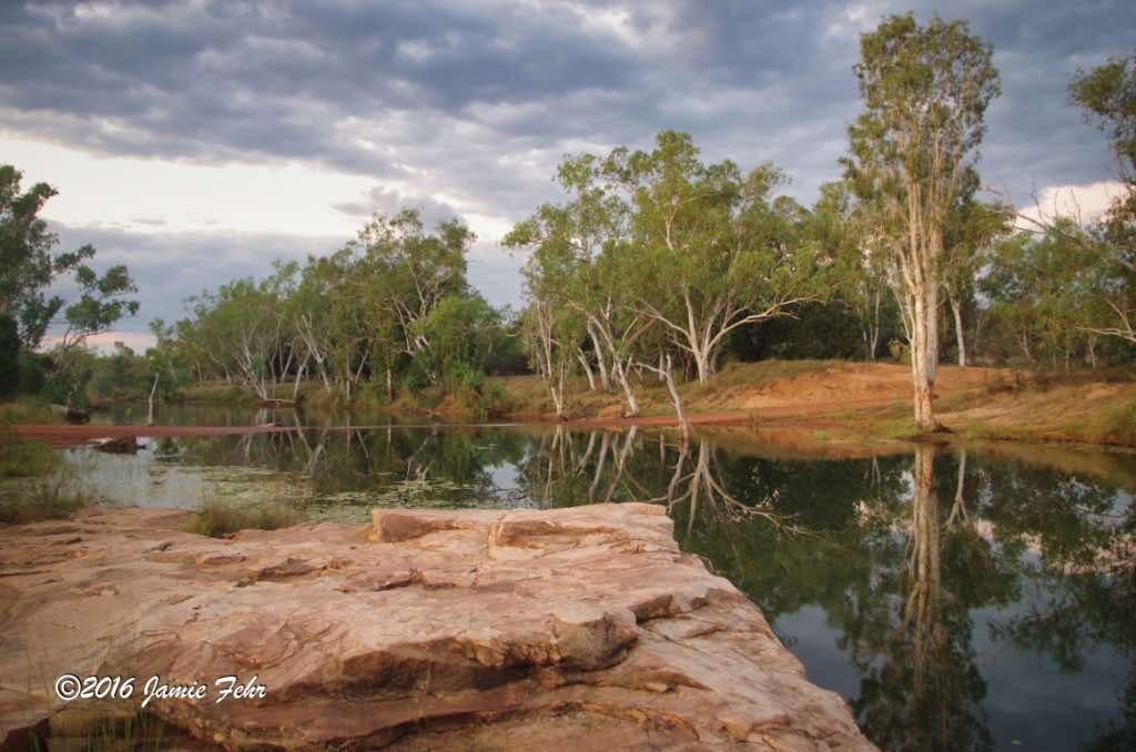
Some of my morning routines while on this road trip included having green tea while Anthony and Emily had coffee, reading my Bible every morning in a beautiful quiet spot, and shaving when needed.
Where we were camped was close to the ocean’s edge. But we always had to be careful about getting in the water due to the dangerous saltwater crocs that inhabited the area. We ended up not seeing any crocs for the duration of our stay, but we knew that they could be there.
One morning, after Anthony had warned us to be cautious about the crocs; I decided that I needed to shave.
I cautiously approached some shallow water’s edge, and used the still water as a mirror to shave. But part of using a razor is cleaning it out between strokes. This is the part that made me most nervous. I imagined that water splashing around would be sure to attract any predators, but I kept my head on a swivel and consoled myself in the fact that it was shallow water, maybe only 4″ deep. If anything were to attempt to come to me in that shallow depth, I assumed that I would see it first! Sure enough, I safely completed shaving, and carried on with my day. Later, when I told Anthony about how my shaving had gone that morning, he expressed concern for me and again warned me to be vigilant and careful.

After a day of exploring and getting a little dirty,
Emily and I wanted to wash our extremities with soap, so Anthony told us that he knew a place where it would be safer to get in the water. After supper, all of us went for a walk a little ways from our camp. Once there, we all decided to walk into the calf-deep ocean water with our bar of soap to wash our legs and arms. That’s when Emily and I discovered something interesting, regular soap does not lather in saltwater. Anthony said he knew about this, but the soap would still help us be clean and smell better. I found it very odd to be using soap without any bubbles present. Anthony then told us that there is a special kind of shampoo (it’s not an actual soap) that will lather in saltwater, but that it was expensive, so he had not bought any. While walking back, we discussed how we would be able to bathe ourselves, as there was nowhere nearby with flowing freshwater. Between the ocean and the non-lathering soap, Emily and I didn’t see any solutions. Anthony came up with an awesome solution, he said that next time it rained, we should use the runoff from the tent to shower under.
Lo and behold, the next evening while we were having supper, it began raining very heavily. At first, we wished it would stop, and all scurried under the tent to keep dry while we ate. We looked over at the remaining slowly-drying clothing and laughed at it dripping on the line again. Thankfully, we had removed the clothing that had completed drying. Suddenly, I remembered that we had wanted to shower the next time it rained. Once I voiced this, then straightaway there was a 3-person lineup to shower! While digging out our bar of soap, we designated a side of the tent that gave us some privacy for our outdoor shower. Anthony & I were gentlemen and let Emily go first. Then I won rock-paper-scissors and got to go next. The runoff from the tent was cool and refreshing, but the shower was not uncomfortably cold, as the air temperature was still warm. Most importantly, our soap lathered! Due to the heavy rain, the water runoff was sufficient to wash away the soapy suds. Just as Anthony was finishing his shower, the rain lessened and stopped shortly after. Tropical rains are often intense but short, so thankfully it rained long enough for us all to get the chance to shower. It felt so good to be squeaky clean and in fresh dry clothes!
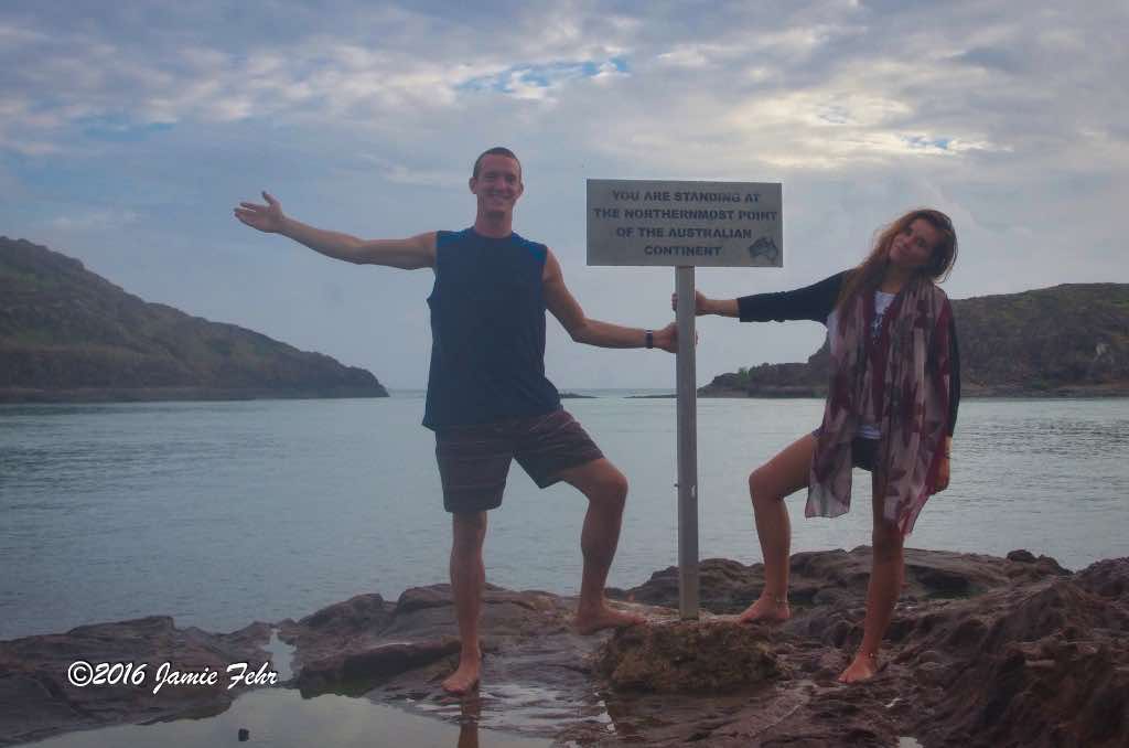
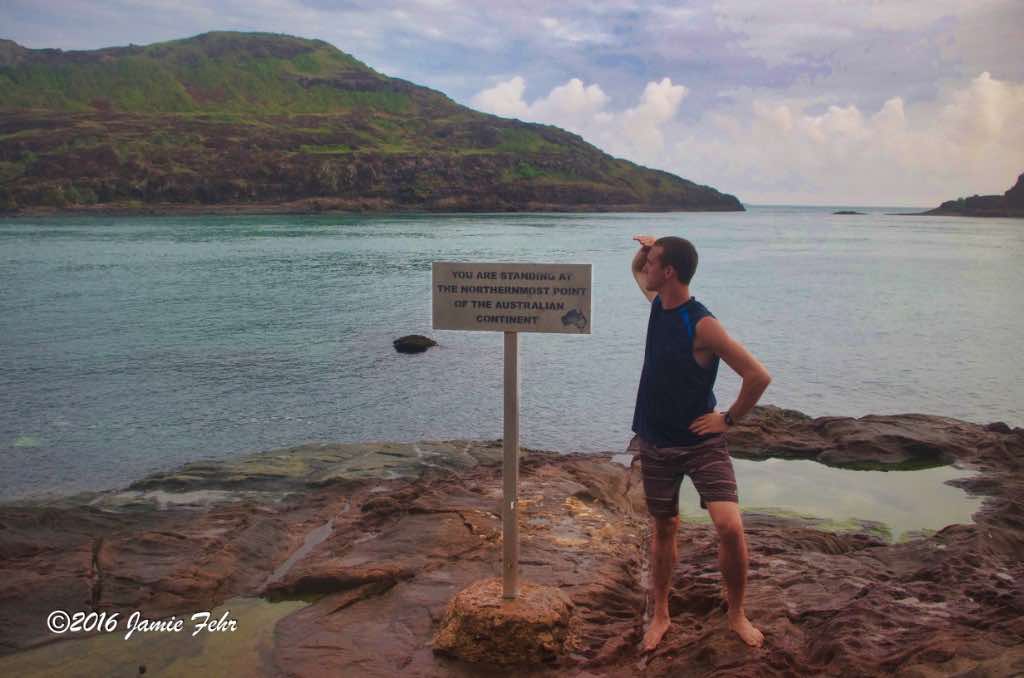
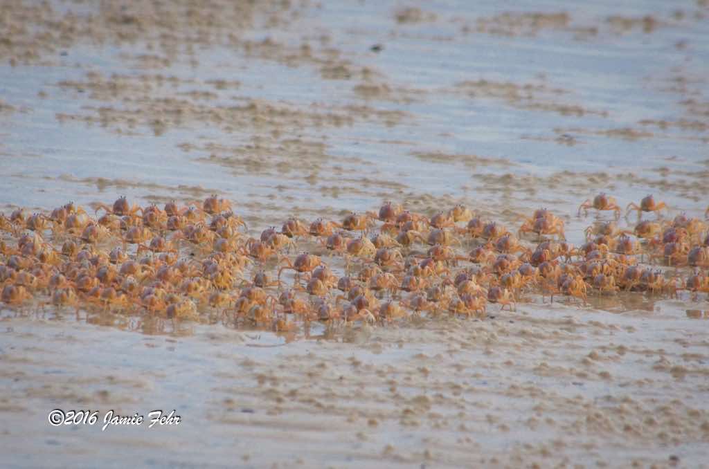
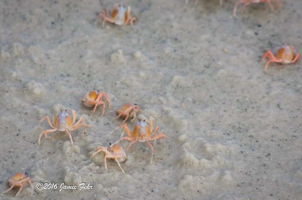
The next morning, Emily and I
got up early and walked to the actual Northernmost point of the Australian continent. After watching the sunrise and taking some fun pictures, we began returning to our camp. While walking back on the beach, we saw a consortium of small crabs. They were interesting to watch, as they ran together. If we got too close to them, then they would bury themselves in the sand! We could not hear an individual one of them running on the sand, but when they all ran together, then we could hear the brisk little “tikka, tikka, tikka, tikka, tikka, tikka” of all their small feet on the wet sand. After we had all worked on packing up, we pointed the Land Cruiser South towards the Old Telegraph Track again.
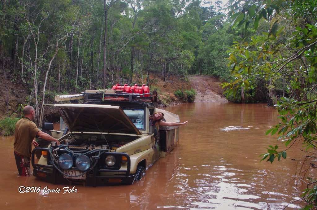
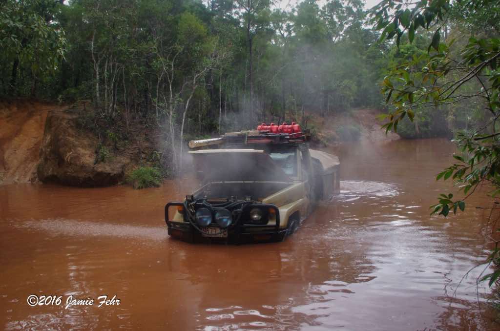
We made good time, and shortly after we re-crossed the Jardine River Ferry, we once again came to Logans Creek. This time, Anthony took a different route than last time, and we didn’t flood. Happily, all of our luggage stayed dry! However, a few creeks later, we came upon Scrubby Creek. While crossing, we did flood the motor and stall. Fortunately, the water was just deep enough to have gotten the distributor wet while we pushed a wave with the Land Cruiser. After drying everything under the hood, we were able to start back up and drive out.


When I met Anthony,
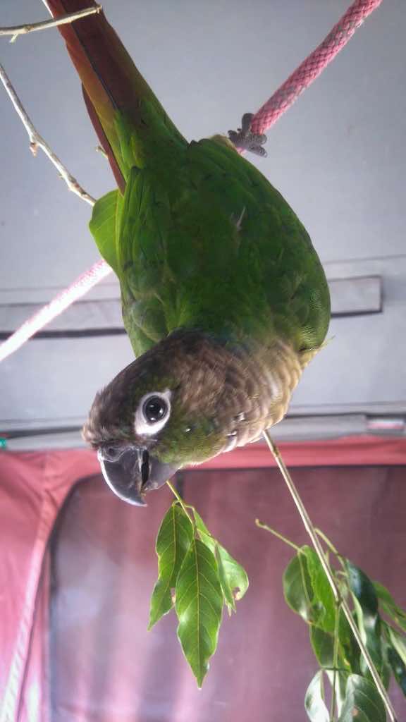
he had his pet parrot with him. He loved that bird, and it brought him joy throughout our travels. His parrot’s name was Minty, but most often he called it “Birdie”. During the day while we were driving, it would usually ride with us on any of our shoulders, happy as could be. At night, Anthony tied a rope inside the top of his tent, and that’s where Birdie would sleep. Anthony usually hung a small branch of a Gum Tree on Birdie’s night perch. Did you know? There are over 700 known species of Gum Trees, and the Eucalyptus tree is a type of Gum Tree.
As we were travelling South on the Old Telegraph Track, we stopped at Fruit Bat Falls to bathe with soap, then swim. While we all went swimming, Anthony left Birdie on a tree branch, and he stayed there till we came back to collect him as we left.
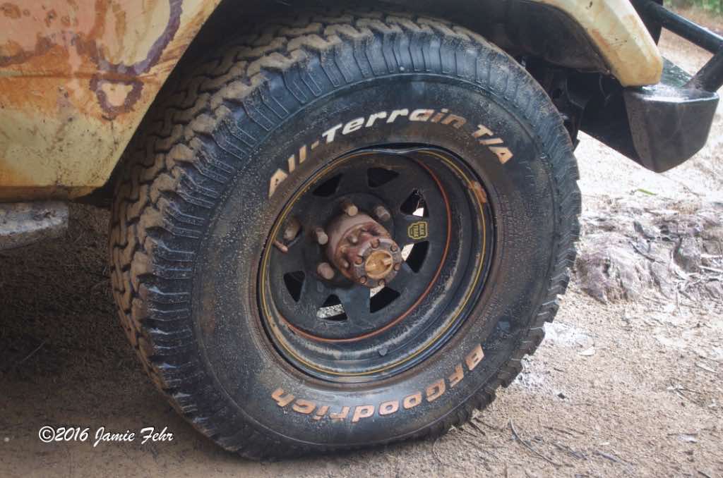
Continuing farther south, we had a bit of a misadventure while crossing Cockatoo Creek. While driving through the creek, the front of our vehicle suddenly slipped and jolted sideways, causing our front driver-side wheel to hit an underwater rock very hard. Immediately, we heard a bubbling from in the water by that tire. Anthony took one look out of his driver-side window, then told us that we needed to get out of the water as quickly as we safely could. Of course, I was concerned and wondered what had happened. As soon as that wheel was out of the water, we could hear a great hissing. Once we were back on dry ground, Anthony jumped out and quickly investigated. Just as he had suspected, that underwater rock had bent the rim and broken the seal of the tire’s bead, which allowed air to free-flow out of that tire! Thankfully, the rock had not damaged the tire’s sidewall. He hurriedly found his hammer, then began waling on that rim with much gusto. After quite a series of blows, the hissing slowed greatly. Then Anthony got to work changing this wheel with the only spare we had. Once that was successfully done, and he had installed the damaged wheel on the spare wheel bracket, Anthony continued hammering on that rim until he had completely fixed the rim and sealed the tire’s bead again. He did such a good job that I couldn’t even see where the damage had been. Anthony explained that we needed to get that tire filled with air at the next servo we came across. Because as it stood then, it was like we didn’t have a spare wheel; which way back out there was an uncomfortable feeling. We filled it with air the next day (which was our first chance to do so), then we all breathed a little easier!


The most famous crossing
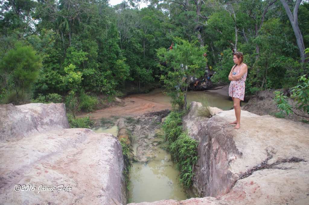
on the Old Telegraph Track is Gunshot Creek, and this was our next challenge. There is a milder route called the “slingshot”, but many would say the proper way is to drive it using one of the steep drops. It has been said that taking the steep drop can also be the scariest of all crossings. The drop is so steep that once you line up and start down it, you can’t see where you are going until your ute (an Aussie term for a truck) has tipped past the point of no return. This obviously needs to be driven slowly, so as to keep your ute undamaged. For more info about the term “ute”, check out this Wikipedia article.
Near the end of this post, you can see a video clip of this, in my Old Telegraph Track North video, at the 1:34 mark.


Dropping down to Gunshot Creek with the aid of gravity while travelling North is one thing, but climbing that same hill when travelling South is quite another. Anthony took a couple of runs at it, but his Land Cruiser was simply unable to climb that steep hill under its own power. The only reason we made it up at all was because we winched ourselves up.
The water crossing of Gunshot Creek itself is pretty mild, all the hype is about the very steep tracks carved into the bank near the creek. On one side of the creek, there is a tree with many items thrown over, draped across, or tied onto its branches. It’s a place where many travellers toss or tie something as they pass by, it’s sort of a tradition. But when the wet season comes, all that water tears away many of the lower items. Thus, it also seems to be a bit of a contest to see how far up on the tree you can toss or tie your items so they can stay caught high in the branches. For those who make the trek annually, it is a chance to see if their items stayed, or got washed away.

Later that day, we stopped to make camp right beside Bertie Creek. While we were preparing supper, Birdie was sleeping in the tent. Suddenly he fell off his rope, flapped about in distress, and died. Anthony reckoned that he must have eaten some of the sap or leaves from the tree that he had been sitting on while we swam at Fruit Bat Falls earlier. That must have poisoned him, and was a buzzkill for the rest of the night. We all ate supper, but later and slower. The next morning, Anthony left Minty in a “house” he built from scavenged materials and hung off a branch on a tree by Bertie Creek, as a sort of memorial/final resting place. It was symbolic that “Birdie” was left to rest at Bertie Creek. Before we left, Anthony played the song “See You Again” by Wiz Khalifa (from the Fast & Furious 7 Soundtrack). That’s why I incorporated that song into my Old Telegraph Track South video.
As an interesting side note, I saw a Facebook post from Anthony a couple of years after we made our journey. He was travelling up the Old Telegraph Track again with more backpackers, and Minty’s house was still hanging off that same tree branch. That is cool!
After leaving Bertie Creek,
we drove for just under two hours, then we returned to the Bramwell Junction Roadhouse. That signified the end of the Old Telegraph Track. We had now driven it the “regular way” everyone does (North), and in reverse (South).
After refuelling, we bought some beef pies for breakfast, then continued SW out of the Cape York peninsula.

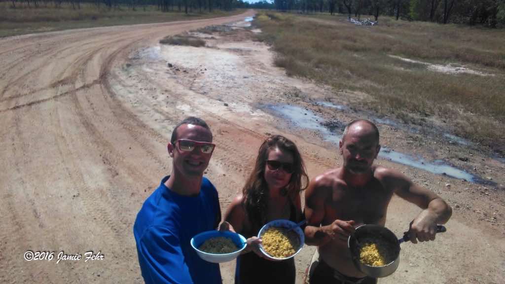

It is very important for the driver to walk creek crossings before driving across them, so he knows if there is anything dangerous he needs to avoid. Things like holes, soft sections, etc. Our long-term goal was to drive West to Darwin, then past it, all the way to the Western coast; then continuing to drive partway down that coast. Some of the roads had very few other vehicles travelling on them, so we often stopped and cooked lunch while pulled over. As much as possible, we quietly free-camped along the way. When necessary and when weather permitted, we used the “quick setup” method. Doing so, we didn’t fully stretch the tent over the ute, and we only pegged down as little as we needed to. This made for a very quick teardown the next morning.


Eventually, we started driving
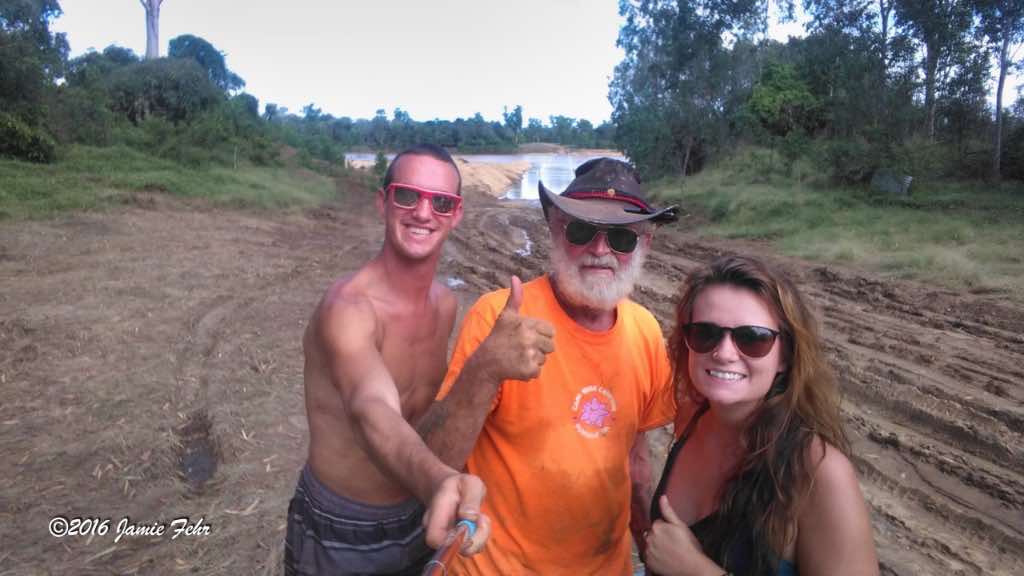
on the Dunbar Koolatah Road. Just after we had crossed the Mitchell River, we met a rancher from the area. An older gentleman named John was also with him, and he was doing a walk for charity. John told us that this was not his first long-distance charity walk, and this time he was walking from The Tip all the way to Perth! He was pulling a cart with all of his gear: tent, food, clothes, etc; and he had food pickups scheduled all along the way. This river crossing was flooded and too dangerous for him to make on foot alone, as he would very likely have been swept away by the strong current! The rancher had offered to use his tractor to pick up John’s cart, then gave John and his cart a ride across the fast-flowing river. But John wanted to stay true to his mission and walk the entire road. So, the rancher picked up John’s cart and slowly drove across the river, while John hung onto the tractor and walked through the water on the leeward side, as the tractor sheltered him from the swift current. Afterward, John took a bunch of things out of his cart to reorganize after it had been lifted and jostled on the tractor, then he repacked his cart.
We struck up a conversation with the rancher and inquired about the condition of the roads farther down our intended path.
Anthony later explained to Emily and me how the ranchers often use helicopters to get around, because in those remote places, the ranches cover enormous tracts of land. That also meant that they had the best knowledge of the current conditions of the rivers and the roads. Interesting fact: Sometimes, the ranchers even use their helicopters for driving their cattle, in combination with cowboys on horseback and/or motorbikes. Here’s an interesting BBC article about those pilots.
The rancher told us that we had come at a very bad time, as the water was very high and still climbing, it had not yet hit its peak. We decided to camp there on the river’s edge for a couple of days, to see if the situation would improve.


John camped near us that first night before he carried on in his journey, so we invited him to join us for some cold drinks & conversation after supper. It was nice to spend an evening with John; he was a funny bloke who had lots of stories to tell!
The next morning, before John left, the rancher surprised John by taking him up in his helicopter. Upon his return, he told us how everything was very flooded!



One evening, Anthony told us
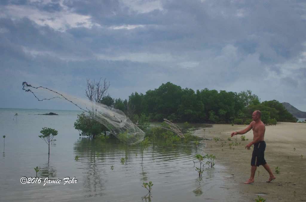
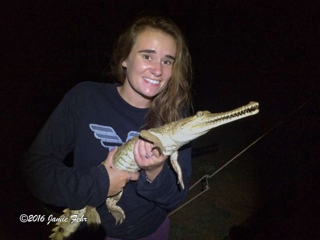
he was going to catch a freshwater crocodile with his cast net. I thought he was joking until he went out to the water’s edge with his headtorch, and a few minutes later he called us over. Sure enough, he had caught one! It was about four feet or a little longer from nose to tail. As long as we kept a good grip on it, it seemed to be pretty docile (almost as if it had given up any fight). We all took turns taking some pictures while holding it, then we let it go. Sometime that evening Anthony also caught a shark on his fishing line that he said was too big to keep (I believe because it would have provided more meat than we could properly store). So after taking a couple of pictures, we released it. Later that night, we spent some time looking at the vast starry night sky. I always enjoy seeing the Southern Cross constellation; it is known amongst the astronomy community simply as Crux (Latin for “cross”). Check out this Wikipedia article for more information about this constellation. That was a good night!


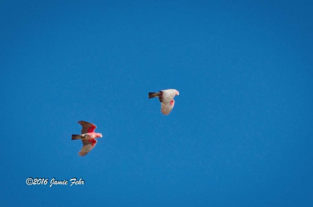

After camping in that spot for two nights, much to our chagrin, we observed that the Mitchell River had not receded at all. We also talked to the few ranchers who came by, and learned that the water was too high for us to make it if we carried on. One rancher’s wife told us that if we were a week earlier we would have made it with ease. But this week was a different story, as it had not rained that much in the month of May since 1974! They were seeing a 42-year record get smashed, crazy!
On top of that, we didn’t have enough fuel to attempt carrying on, with the high probability that we would have to turn around and backtrack. Anthony stated that if we tried pressing on, we would very likely run out of petrol. Then, our only hope would be to beg a rancher to sell us some, if/once they found us. But seeing as we had talked to all the ranchers in the area, and they all warned us not to continue, that would be a foolish, long shot.
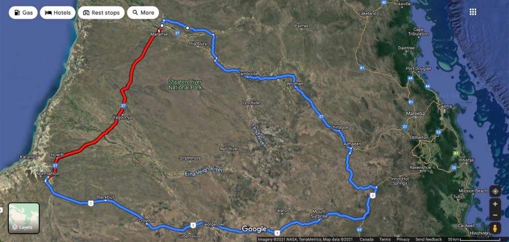
We really wanted to go directly to Normanton, because that was the shortest route. But we decided to heed the rancher’s warnings, so we crossed the fast-flowing Mitchell River again, then backtracked. We turned towards Chillagoe, then eventually towards Mount Surprise. I had visited that town before and did not expect to return. That was a *ahem* pleasant surprise, pun intended!
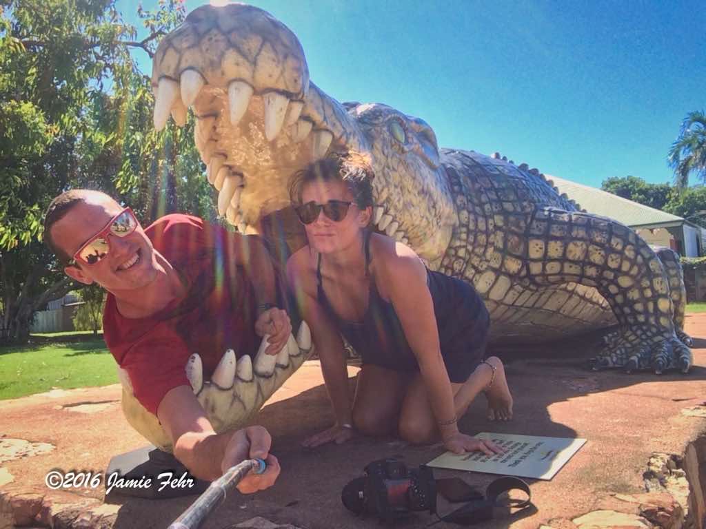
Two and a half days later, we finally made it to Normanton. It would have been about 250 km’s from where we were on the Mitchell River, but instead, we had driven about 950 km’s! That was an adventure! While there, we took some tourist photos with a giant croc!
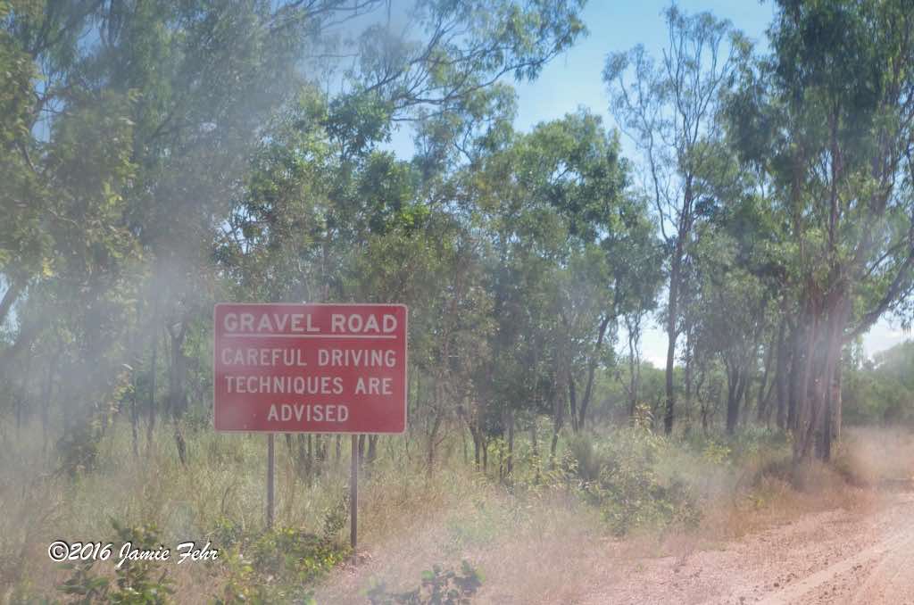
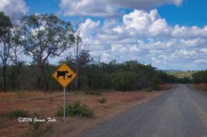
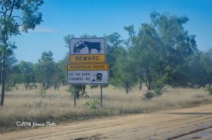
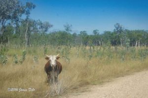

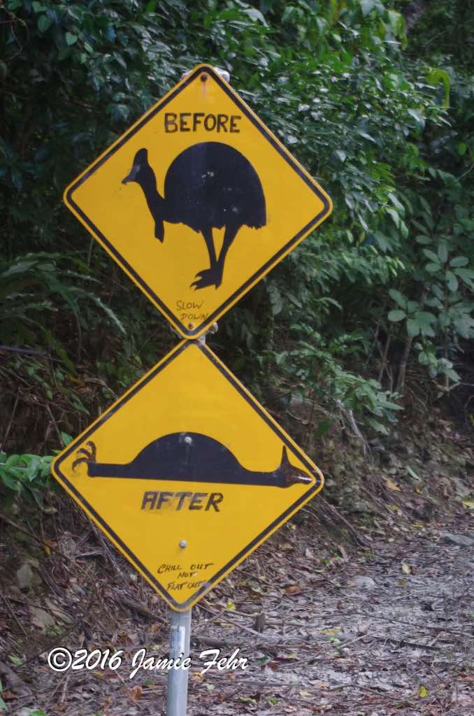
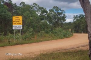
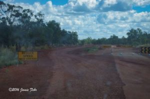
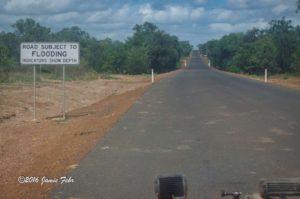
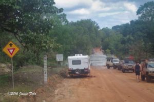
I saw some interesting road signs
on this trip. Some were intriguing simply because I had never seen them before, and others were memorable because they had been slightly vandalized with some tasteful, well-suited, creative graffiti. Those ones had been turned into funny signs!
The Cassowary speed bump warning sign originally was just an indicator that there was a speed bump on the road there; to keep drivers slow because Cassowaries frequently ran out on the road from the rain forest at that place. But somebody drew on the sign, making it look like a Cassowary had been hit. The sign bore the same message, but now it was funnier!
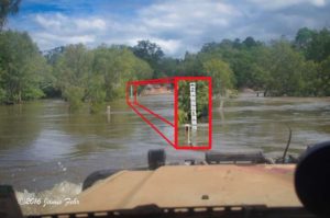
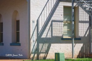
I found it interesting that many, if not all, of the creeks and rivers have water depth indicator signs surrounding them. That way, when the water is high, drivers are informed about how deep the water is before driving in. On a building in the middle of the town of Normanton, there was even a depth indicator sign showing up to 10 meters high!

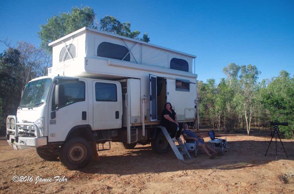
The 12v system in Anthony’s Land Cruiser was unable to charge my laptop and SLR battery. I remember travelling for days, without power to recharge them. When my SLR’s battery got low, I carefully planned when I would use that camera; sometimes deferring to use my iPhone, which I could charge in the Land Cruiser. Then would come that sad moment when my SLR would not power up. I was only able to charge it when we were parked for a night somewhere that was hooked into grid power. Alternatively, there was a time or two when I met a neighbour free camping beside us who had a big enough off-grid system to allow me to charge my things. That always meant leaving my laptop or SLR battery overnight with my neighbours while I slept, which took some trust, but I had no other options. Thankfully, they were all stand-up people, so they always gave me back my fully charged things in the morning, what a relief!
One such couple was Giles and Lynda. They were kind and had lots of travelling stories to share, as they have travelled Australia extensively. Lynda is a wildlife photographer and uses a long lens. We quickly began discussing some of the local flora and fauna that I had been attempting to photograph, but could not identify yet. Thankfully, Lynda was able to help me with some of my missing IDs. It was just so nice to be able to talk to a few other people while on this journey. Antony and Emily were good people, but being with them for 24 hours of every day of our trip made it a treat to have conversations with others.
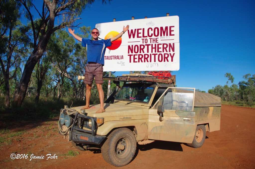
And then one day,
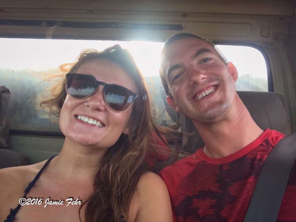
we crossed from Queensland into the Northern Territory. Of course, I had to stop and take my tourist picture with the big sign. It felt like we had travelled so far, but little did I know that I was less than one-quarter of the way to Perth! I didn’t know it at the time, but I would not be returning. I look forward to the day that I can return to the amazing Queensland, I think that it is my favourite Australian state!


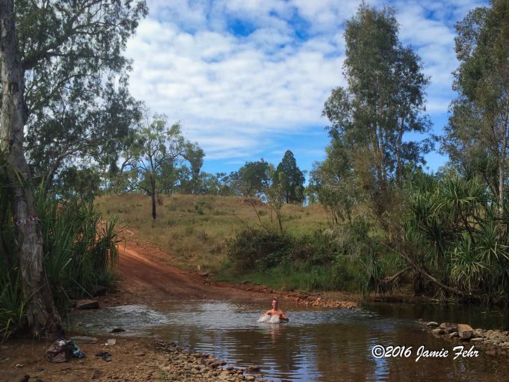
While travelling in the vehicle for days at a time and walking around mostly barefoot on the dusty ground; the need for a rinse when one was available quickly became apparent. Therefore, when we saw a good opportunity, we didn’t pass it up. One day, we crossed a very small creek, then stopped for lunch in a little open spot next to the water. While eating, we discussed how this creek looked just deep enough for us to sit in and bathe. The only issue was the best place to enter the water and bathe also happened to be where the road crossed the creek. Considering that it had been a couple of days since we’d used soap, we decided to take the risk; but we had to be quick about it because we never knew when another vehicle was going to drive down the road. One at a time, we all bathed in that little creek. And sure enough, just after the last of us finished and was still drying off, there came another vehicle! Boy did it sure feel nice to be clean and smell good again!


Later that day, we were driving along listening to our music, suddenly Anthony slammed on his brakes, turned down the music, and turned around. This obviously caused Emily and I to wonder what was up, then he told me to get my camera out. He reminded us that this was his third time driving around Australia, and told us that in all of his travels, he had never seen this animal yet. We were in for a treat! He drove off the road a bit, back close to a bog. Standing in that muddy bog, was a large bull Australian Swamp Water Buffalo. I think it was probably the biggest, most muscular animal I have ever laid eyes on! It was so muscular; had wide, large, swept-back, black horns; and very likely weighed over 1 ton! The way that animal looked at us and postured itself, it seemed that it was thinking/saying to us “This is MY territory, why do you dare approach me?” What a treat indeed! After I had taken some quick photos, we got out of there pretty quickly. Anthony said that we did not want to antagonize that bull into charging at us! Indeed not!! For more information on these interesting animals, check out this link.
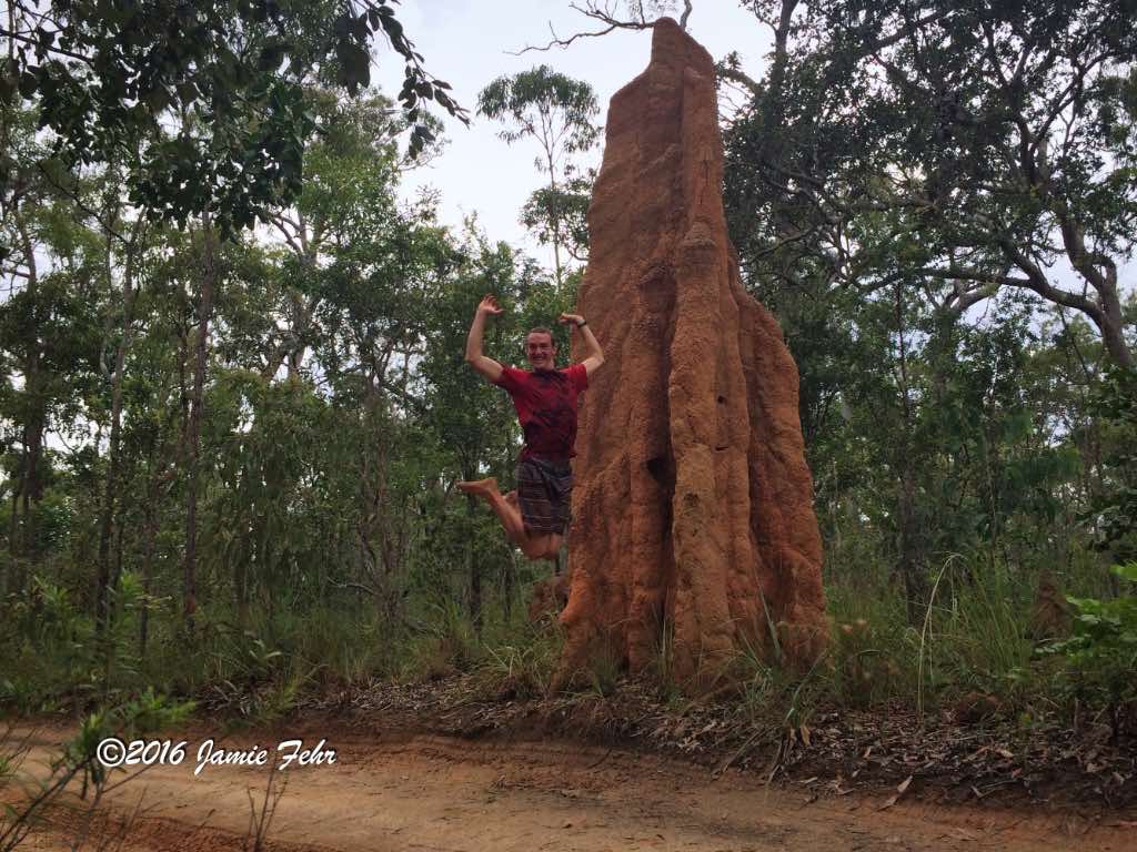
Also, look at the termite mounds in these pictures, and see how different they look from the big tall ones that I mentioned earlier. These are much shorter.

For the entire duration of our driving
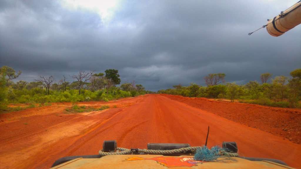
on the Old Telegraph Track, I had a GoPro mounted on the front of the Land Cruiser. For most of the journey, I had it set to take a picture every 30 seconds, but changed it to video for some of the water crossings. Once we were past the Telly Track, I spent lots of time putting all those pictures and videos together into two videos; one for our trek North, and one for our journey South.
Here are the links to those videos:
Old Telegraph Track North video
Old Telegraph Track South video
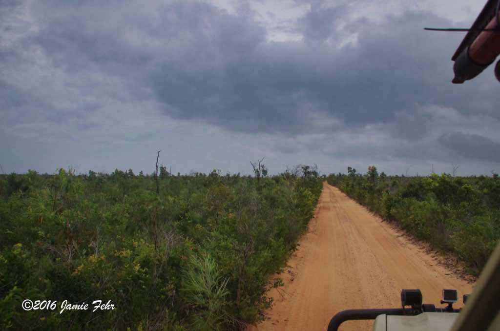
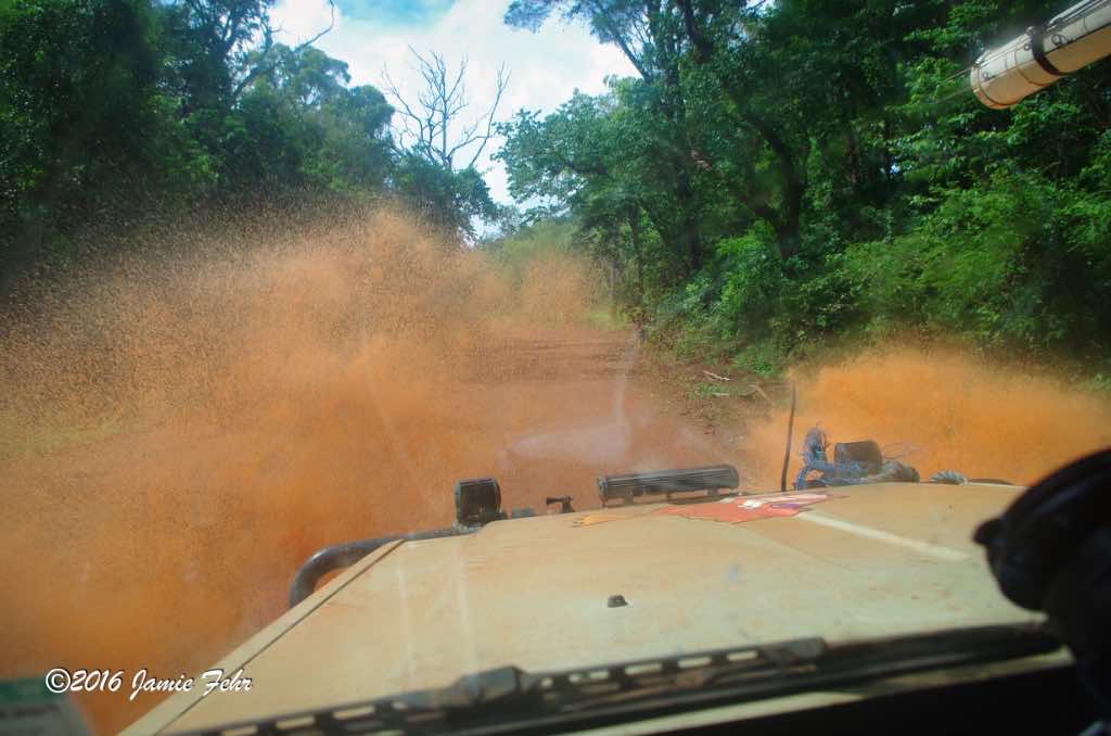
They are a little on the longer side, but something interesting you will notice as you watch them is how the land and trees changed as we drove. You will notice the color of the soil change, and as we drove up to a higher elevation the trees changed. At our highest point on the Old Telegraph Track, the trees were shorter and more wind-swept. Then as we drove back down again the vegetation got lusher. I found this fascinating, how even in a rainforest there are subtle (and sometimes not-so-subtle) differences. Another difference I noticed is the size of the termite mounds. They were quite tall amongst the lush trees, but the termites built much shorter mounds where the trees were shorter and there was more wind. That’s just my best guess regarding the changes I saw in their mounds, but who knows what the termites were really thinking.
For the videos, I chose songs that brought back memories of being on this trip, as all of those songs were included in Anthony’s playlist. The weather was hot and dry on the way up North, but we drove through a bunch of rain on the way back down South; which is why in the video there is water on the lens. It was raining too much to keep the lens dry all the time.
There are a couple of memorable places in the videos, here they are:
Old Telegraph Track North:
1:34 – When we crossed Gunshot Creek, first dropping down the steep hill. You can also see the tree where people tossed stuff onto its branches.
3:40 – When Anthony walked Cockatoo Creek before driving it.
5:28 – When we passed the cyclists and their support vehicle.
5:36 – The Cypress Creek log bridge (it’s just one photo frame in the video).
6:12 – When we got flooded crossing Logans Creek.
7:55 – When we crossed (I believe) Nolans Brook.
8:28 – When we drove into a deep rut that we couldn’t drive out of, so we were towed out by the cyclist’s support vehicle that was behind us.
Old Telegraph Track South:
2:00 – When we crossed Scrubby Creek, and stalled out.
4:21 – When we drove up the very steep hill, with some winching help, at Gunshot Creek (the creek crossing itself wasn’t recorded on video).
8:57 – When we pulled into a “passing pullout” to let some oncoming traffic pass us.
9:03 – When Anthony walked (I believe) Dulhunty River before driving it.

Near the end of my travels with Anthony,
while travelling South down Australia’s West Coast, I met a young couple, Herbie and Shannon. They were travelling in their camper van, going the same direction as us. A couple of non-consecutive nights, we stayed at the same campgrounds. We hung out in the evenings, so I got to know them a bit. Knowing that my ride with Anthony would end before I got to Perth, I enquired if I could continue my journey with them. That worked out quite nicely, and once Anthony had taken me as far South as he planned to travel, Herbie & Shannon picked me up. I travelled with them all the way to Perth, and once there we explored Rottnest Island together. I will write about my travels with them in a future post, check it out here. (link to come in the future, after it’s posted)
In total, I travelled approximately 9,300 km’s with Anthony and Emily, then almost 1,000 km’s with Herbie and Shannon! That was one colossal 10,300 km’s road trip!
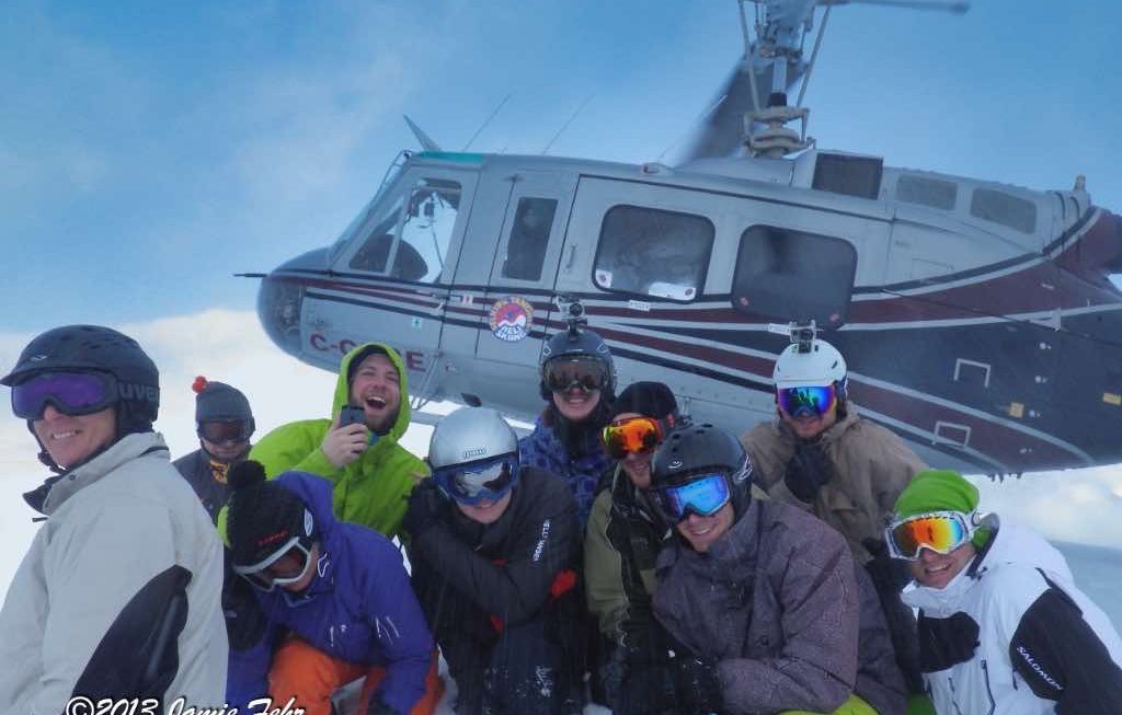
I hope that you enjoyed reading this post as much as I enjoyed living it, as that sure was one wild adventure! Please join me next month, when I will bring you back to my home country of Canada, for a winter adventure. I will be sharing about the day I spent heliskiing with some of my friends.
Till next time, keep dreaming big!
» Jamie
“Never let your memories be greater than your dreams” – Douglas Ivester”
